
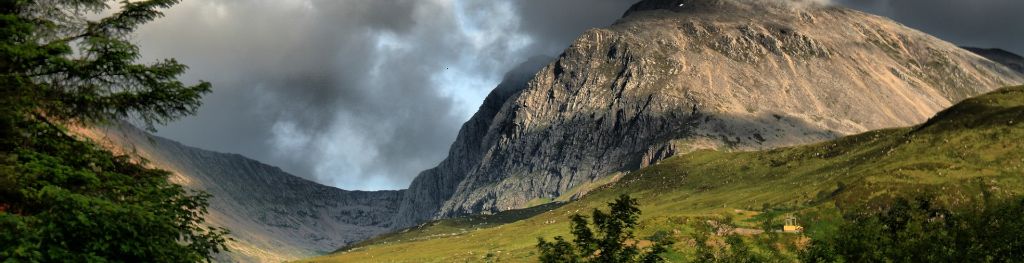
Mountain weather
Southwest Highlands Mountain weather forecast table
Confidence
Generally high confidence over the coming days but moderate for detail of low cloud and showers. Confidence becoming low by late Wednesday/Thursday on development and movement of a low pressure system.
This evening forecast
Some late sunshine to end the day, with heavy showers in the east soon dying off. Light, variable winds.
Mountain weather hazards
Hazards apply at or above 300m, reflecting the more severe conditions which can occur at altitude.
 Thunderstorms
Lightning is a significant mountain hazard which can result in serious injury or death. Mountain terrain often leaves one highly exposed to lightning strikes. Hail may give unpleasant conditions with torrential rain and localised flash flooding also possible, mainly in Summer months.
Strong Sunlight
Harmful UV levels from sunlight increase with altitude giving a greater risk of sunburn and eye damage, even on some overcast days. On breezy days, the cooling effect of wind on exposed skin may disguise any feeling of sunburn until it is too late. If there is snow cover, glare increases the effect of UV rays especially on the eyes. It is advisable to wear sun block, protective clothing such as a long-sleeved top and hat and have good quality eye protection.
Poor Visibility
Poor visibility presents challenging route finding conditions. Visibility could be significantly less than 50 metres in all directions with few or no visual references, especially on featureless moors or plateaux. Distances become hard to judge and cliff or cornice edges can be difficult to recognise. These conditions require good navigational skills. There is a risk of white-out conditions when mist or fog is combined with extensive snow cover.
Mountain weather forecast
Patchy cloud, mainly in the east, and sunny spells. Showers developing during the afternoon.
| 00:00 | 03:00 | 06:00 | 09:00 | 12:00 | 15:00 | 18:00 | 21:00 | |
|---|---|---|---|---|---|---|---|---|
Weather (at 800m) |
|
|
|
|
|
|
|
|
Chance of precipitation (at 800m) |
10% | 10% | 10% | 10% | 20% | 40% | 30% | 10% |
Wind direction and speed (mph)
Altitude above mean sea level
| 00:00 | 03:00 | 06:00 | 09:00 | 12:00 | 15:00 | 18:00 | 21:00 | |
|---|---|---|---|---|---|---|---|---|
| 1300m |
N
6
|
NW
9
|
N
9
|
NW
6
|
NW
4
|
NW
7
|
NW
7
|
NE
6
|
| 900m |
E
3
|
NW
3
|
NW
4
|
NW
4
|
NW
4
|
NW
7
|
NW
7
|
E
6
|
| 600m |
W
4
|
W
5
|
W
5
|
NW
3
|
NW
4
|
NW
7
|
NW
7
|
NE
6
|
| 300m |
NE
4
|
NE
3
|
NE
3
|
N
3
|
NW
4
|
W
5
|
NW
6
|
N
4
|
| Glen |
W
5
|
W
4
|
NW
3
|
NW
4
|
W
5
|
W
7
|
W
7
|
NW
3
|
Wind gust (mph)
Altitude above mean sea level
| 00:00 | 03:00 | 06:00 | 09:00 | 12:00 | 15:00 | 18:00 | 21:00 | |
|---|---|---|---|---|---|---|---|---|
| 1300m | 7 | 10 | 11 | 8 | 8 | 11 | 11 | 8 |
| 900m | 4 | 5 | 6 | 7 | 8 | 11 | 10 | 8 |
| 600m | 5 | 7 | 7 | 6 | 7 | 11 | 11 | 9 |
| 300m | 5 | 4 | 5 | 6 | 7 | 8 | 9 | 8 |
| Glen | 9 | 6 | 7 | 6 | 8 | 12 | 11 | 7 |
Altitude above mean sea level
| 00:00 | 03:00 | 06:00 | 09:00 | 12:00 | 15:00 | 18:00 | 21:00 | |
|---|---|---|---|---|---|---|---|---|
| 1300m |
8°
|
8°
|
7°
|
7°
|
8°
|
9°
|
8°
|
8°
|
| 900m |
9°
|
8°
|
9°
|
11°
|
12°
|
13°
|
12°
|
10°
|
| 600m |
11°
|
10°
|
10°
|
11°
|
13°
|
14°
|
14°
|
13°
|
| 300m |
12°
|
11°
|
11°
|
14°
|
16°
|
17°
|
17°
|
14°
|
| Glen |
13°
|
12°
|
13°
|
16°
|
18°
|
19°
|
18°
|
15°
|
| Freezing Level |
2,200m
|
2,100m
|
2,600m
|
2,600m
|
2,500m
|
2,500m
|
2,600m
|
2,500m
|
Altitude above mean sea level
| 00:00 | 03:00 | 06:00 | 09:00 | 12:00 | 15:00 | 18:00 | 21:00 | |
|---|---|---|---|---|---|---|---|---|
| 1300m |
7°
|
5°
|
4°
|
5°
|
6°
|
7°
|
6°
|
6°
|
| 900m |
8°
|
8°
|
8°
|
10°
|
11°
|
12°
|
11°
|
9°
|
| 600m |
10°
|
9°
|
9°
|
10°
|
13°
|
13°
|
13°
|
12°
|
| 300m |
12°
|
11°
|
10°
|
13°
|
15°
|
16°
|
16°
|
14°
|
| Glen |
12°
|
11°
|
12°
|
16°
|
18°
|
18°
|
17°
|
15°
|
Additional weather information
Met Office Aberdeen meteorologist's view
Nothing to add.
Weather
Some clear skies during the overnight period, mainly in the west, with low cloud affecting the east. Low cloud will lift and break during the morning to give brighter spells, best of the sunshine in the west. Showers developing in the south during the afternoon, most likely in the south, with these potentially heavy and thundery. Clouding over for most later in the evening.
Chance of cloud-free hill tops
80%, reducing 40% in the east until around mid-morning
Low cloud and visibility
Scattered/broken cloud base 500-700m in the east during the first part of the morning, lifting and breaking. Few/scattered 600-800m later in the evening. Visibility poor in hill fog, otherwise mainly good, temporary reductions in heavy showers.
Mountain weather information
Weather
A rather cloudy start to the day but this breaking up during the first part of the morning to leave bright or sunny spells for the rest of the day. Best of the sunshine in the west. Chance of a few showers developing in the north.
Chance of cloud-free hill tops
80%
Maximum wind speed expected
Variable 5 mph
Temperature
- At 800m Plus 8 rising to plus 12 Celsius
- Glen Plus 12 rising to plus 19 Celsius
- Freezing level Above summits
Low cloud and visibility
Few or scattered cloud base 500-700m at first, soon lifting and breaking. Visibility generally good, temporary reductions in any showers.
Mountain weather information
Tue 21 May
Sunrise:
Sunset:
Largely dry and sunny during the morning, scattered heavy showers into the afternoon. Light, variable winds.
Wed 22 May
Sunrise:
Sunset:
Rather cloudy with scattered showers. Light to moderate northwesterly winds.
Thu 23 May
Sunrise:
Sunset:
Cloudy and potentially rather wet on Thursday. Moderate to strong northwesterly winds.
Updated at:
Summit specific forecast
Mountain summit forecast map
Loading map…
Key
Including Ben Nevis, Glen Coe and the rest of Lochaber, Argyll including the Isles, Loch Lomond, Trossachs and Arran
For snow and avalanche hazard forecasts please visit Scottish Avalanche Information Service